Log in
All resources
Create a design
1,096,578 Free Images of Maps Of Battles
bibliothèque municipale de reims
1552
rès. g 153
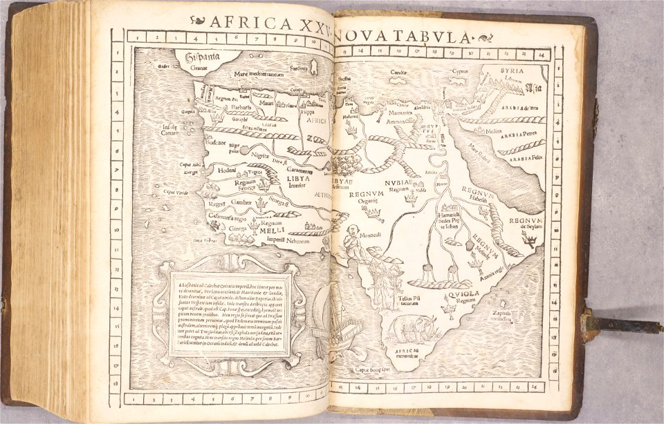
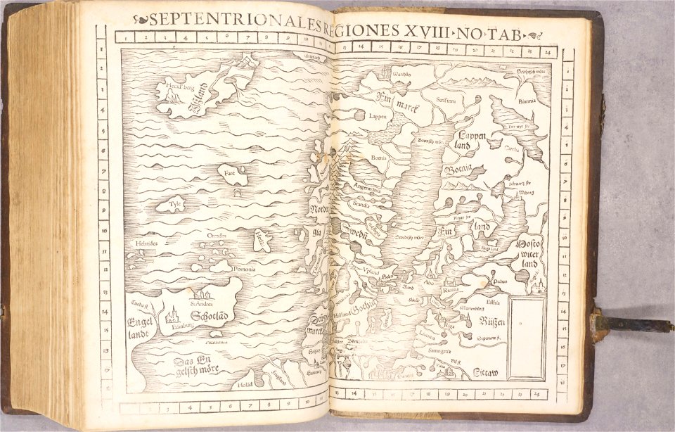
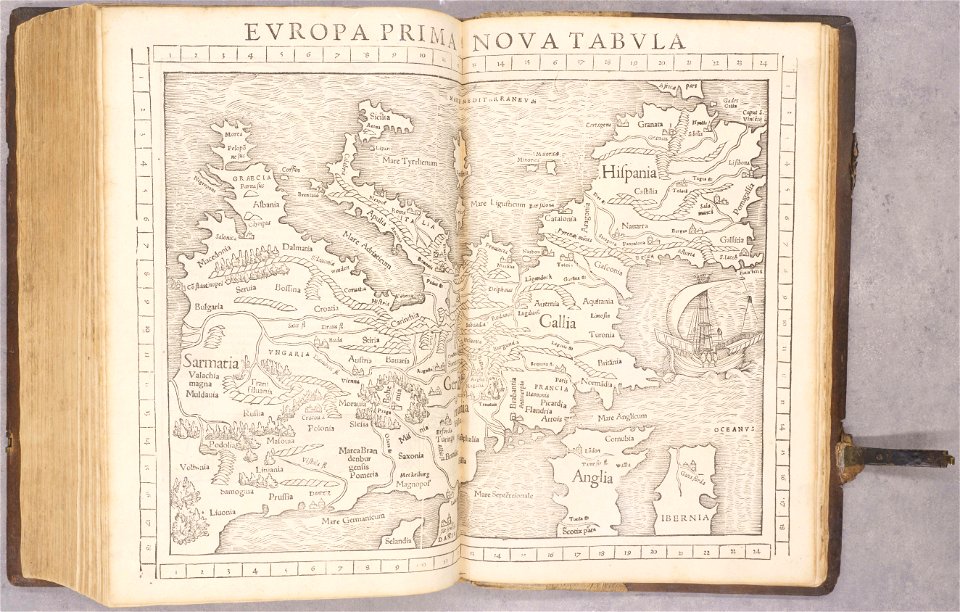
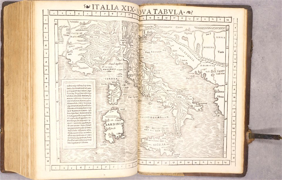
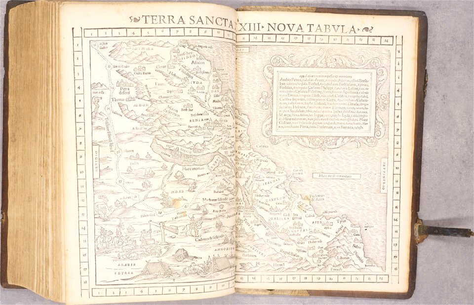
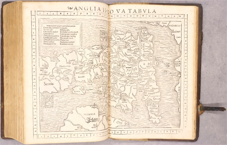
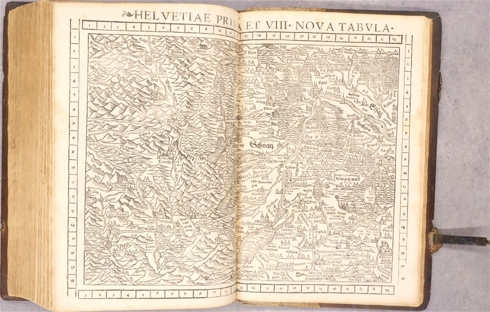
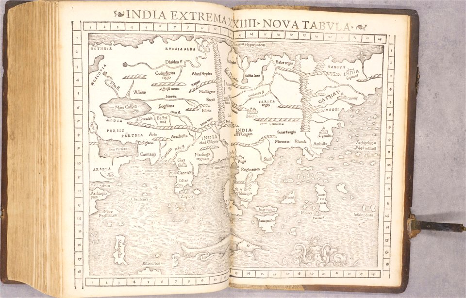
geographiae claudii ptolemaei alexandrini (münster
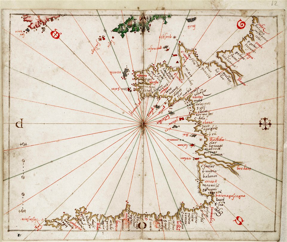
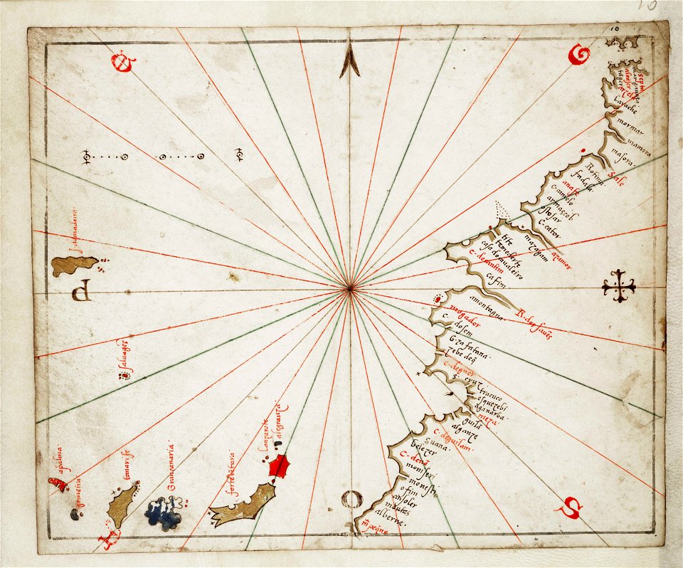
charts and maps of the royal museums greenwich
joan martines
atlante veneto (raremaps.com) volume 1
historical maps of lüneburg
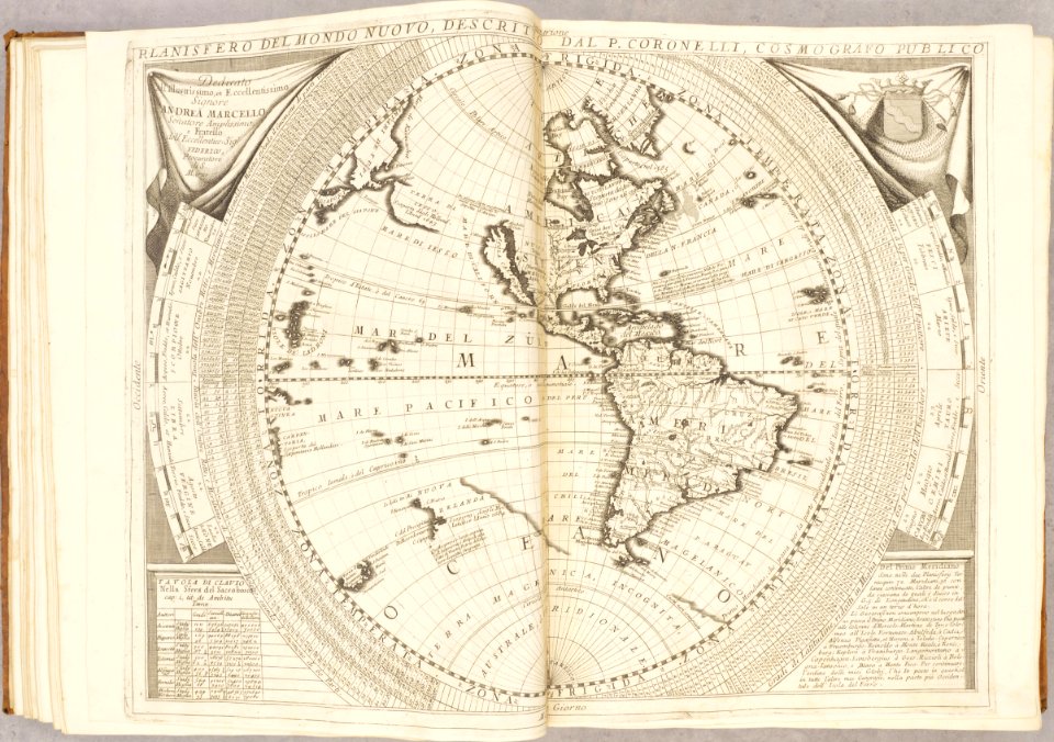
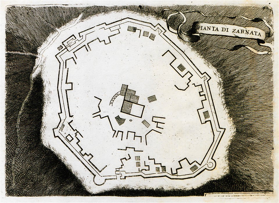
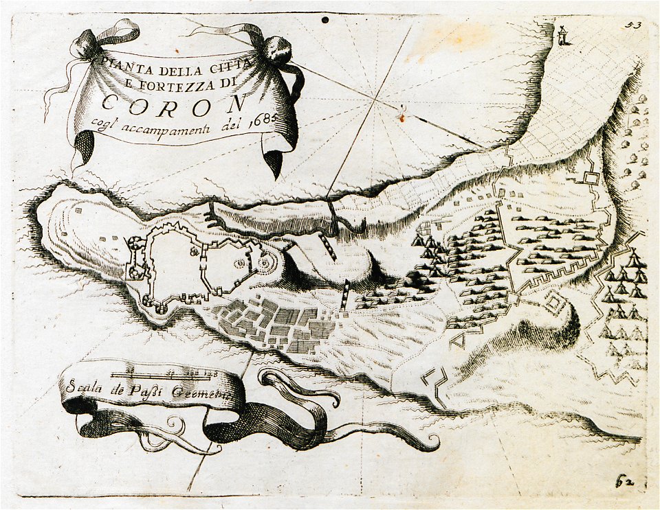
geographical illustrations by coronelli
niedersächsisches landesarchiv
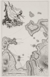
maps of the dutch east india company - st helena
1749
maps of the dutch east india company - sri lanka
1753
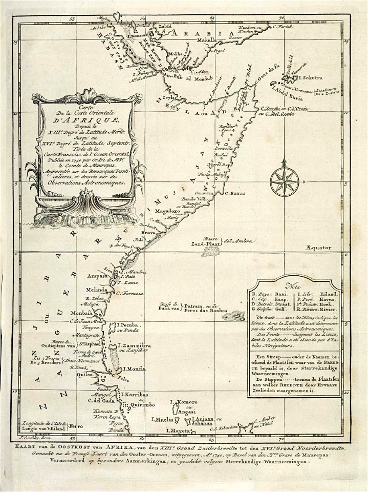
old maps of the dutch east india company - africa
1747)
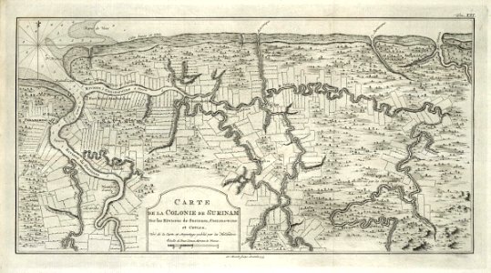
maps of the west-indische compagnie
1773
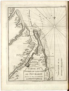
maps of the west-indische compagnie
1773
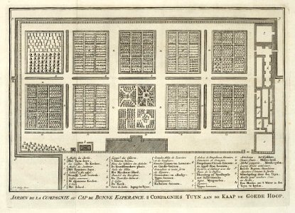
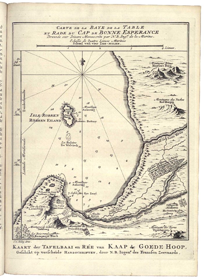
maps of the dutch east india company - south africa
1753
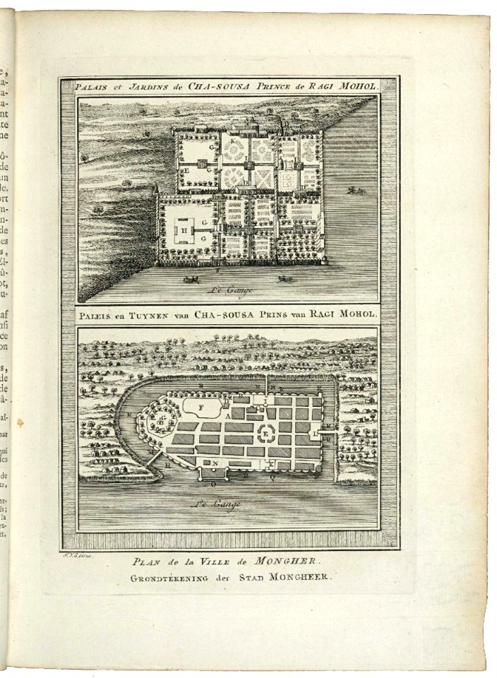
maps of the dutch east india company - india
1755
maps of the dutch east india company - south africa
1747)
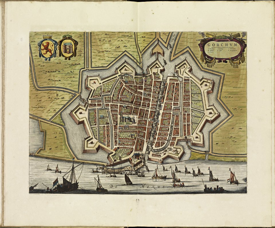
old maps of gorinchem
atlas de wit 1698
copper engravings in the universitätsbibliothek salzburg
old maps of istanbul
liber insularum archipelagi (royal museums greenwich)
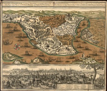
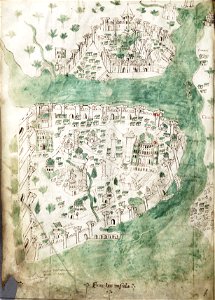
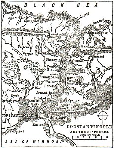
old maps of constantinople
charts and maps of the royal museums greenwich
joan martines
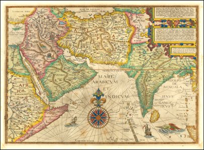
jan huygen van linschoten
1596 maps of asia
atlante veneto (raremaps.com) volume 1
old maps of the danube
atlante veneto (raremaps.com) volume 1
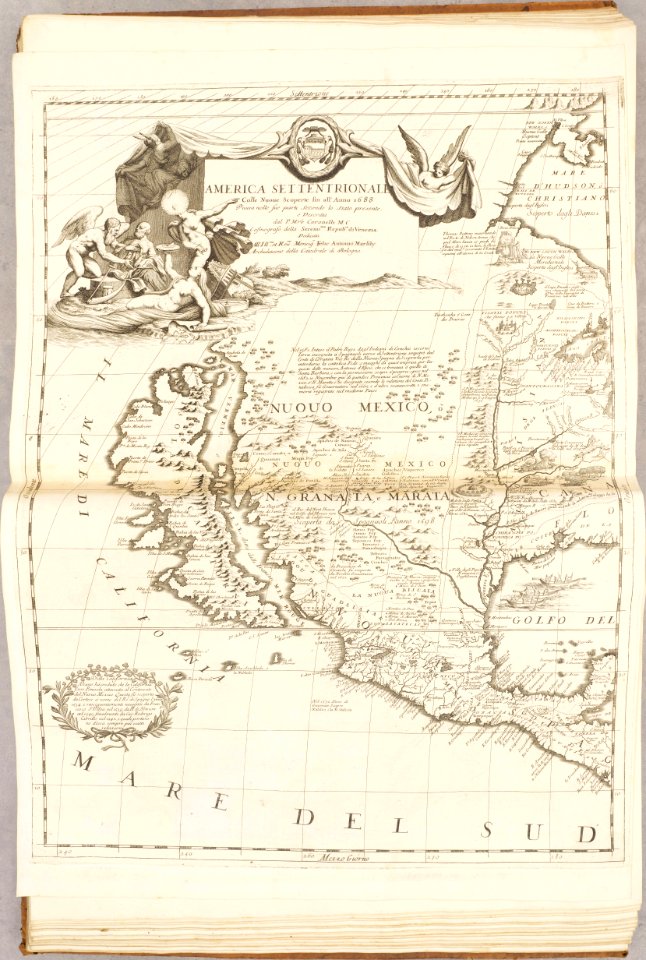
old maps of north america
atlante veneto (raremaps.com) volume 1
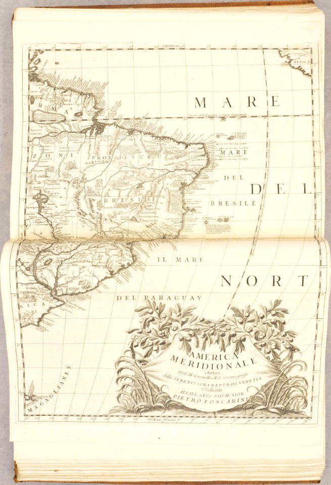
old maps of south america
atlante veneto (raremaps.com) volume 1
old maps of the americas
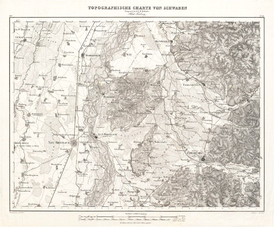
charte von schwaben (bohnenberger)
old maps of freiburg im breisgau
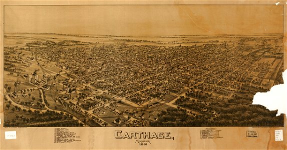
missouri
carthage
bibliothèque municipale de reims
rès. g 153
bibliothèque municipale de reims
rès. g 153
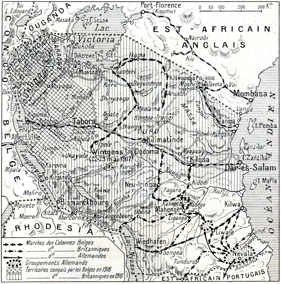
african theatre maps of world war i
no 3908 illustrations
bibliothèque municipale de reims
rès. g 153
old maps of bohemia
1552
old maps of transylvania
1552
1550s maps of africa
1552
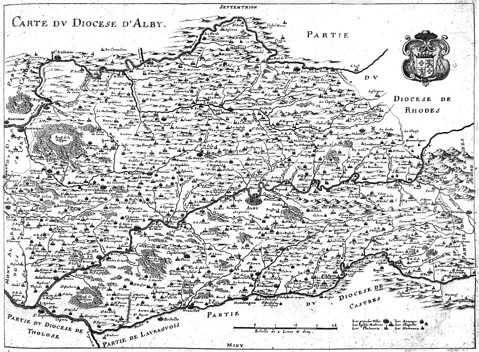
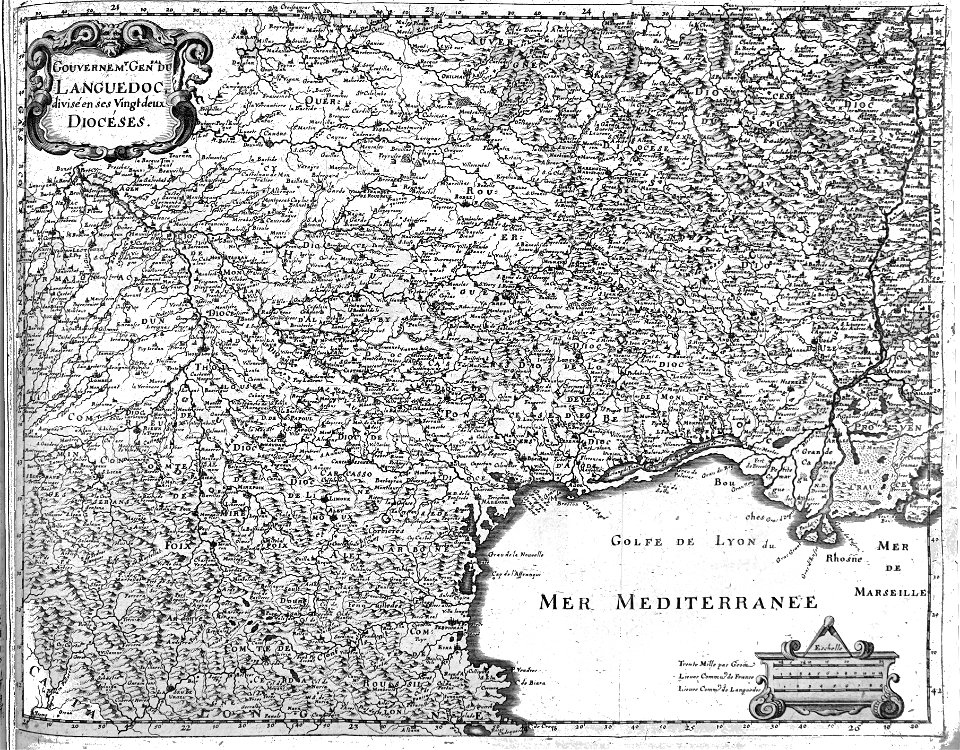
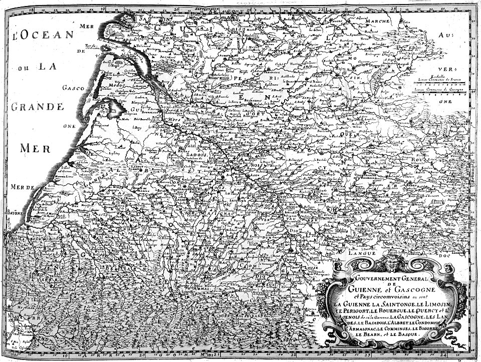
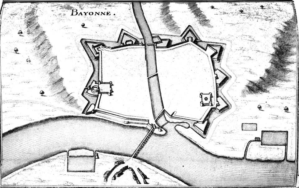
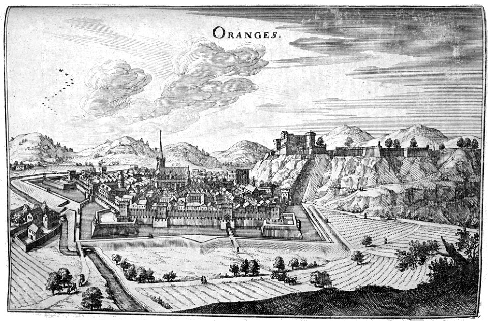
old maps of france
1552
old maps of scandinavia
1552
geographiae claudii ptolemaei alexandrini (münster
1552
old maps of italy
1552
old maps of palestine
1552
old maps of england
1552
old maps of switzerland
1552
old maps of asia
1552
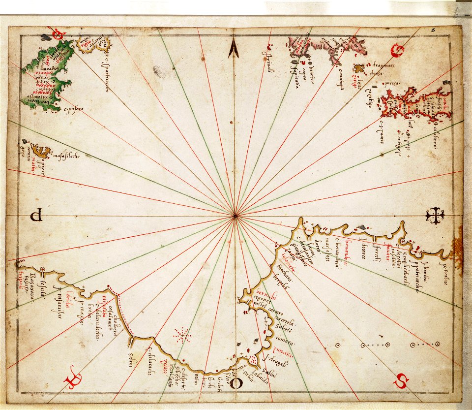
charts and maps of the royal museums greenwich
joan martines
bibliothèque municipale de reims
rès. g 153
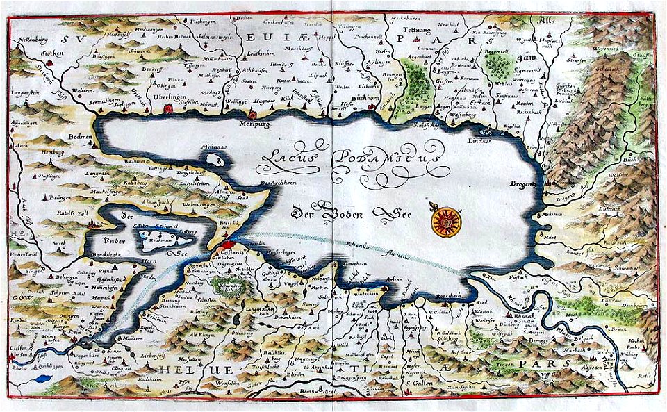
rhaetiae et valesiae
merian helvetiae
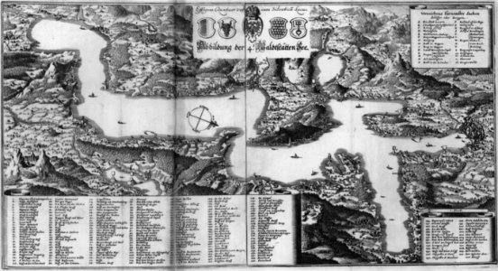
naval war on lake constance
old maps of lake constance
bibliothèque municipale de reims
rès. g 153
bibliothèque municipale de reims
rès. g 153
images from the new student's reference work
maps of constantinople
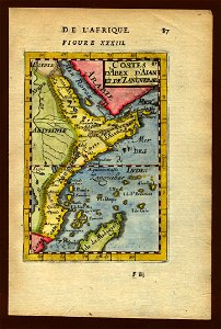
description de l'universe
zanzibar in art
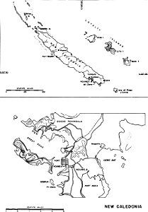
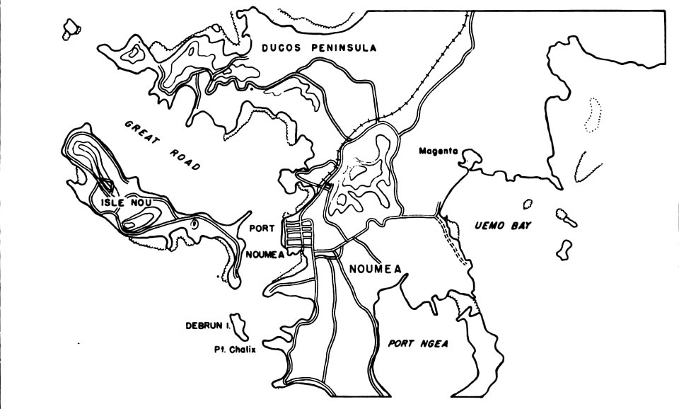
nouméa in world war ii
nouméa
nouméa in world war ii
nouméa
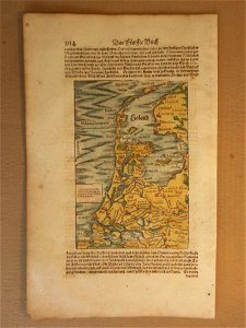
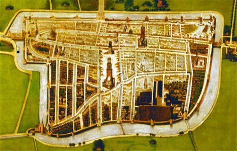
cosmographia (1600) by sebastian münster
1600 maps of the netherlands
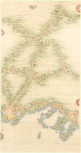
yamaguchi prefectural archives
maps of yamaguchi prefecture
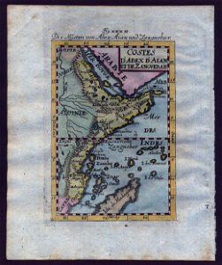
description de l'universe
zanzibar in art
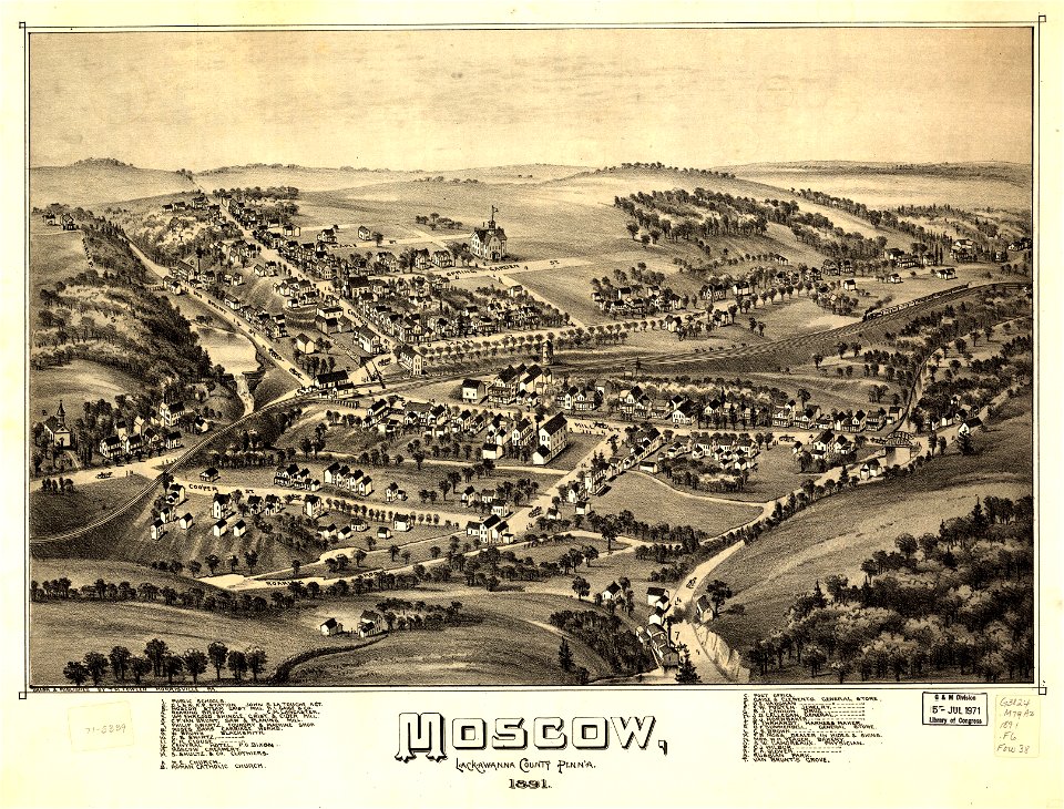
pennsylvania
moscow
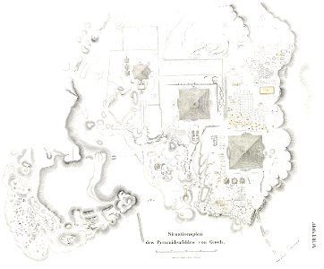
lepsius-projekt - pyramids
plans of giza necropolis
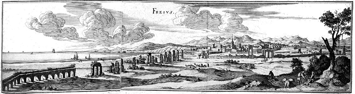
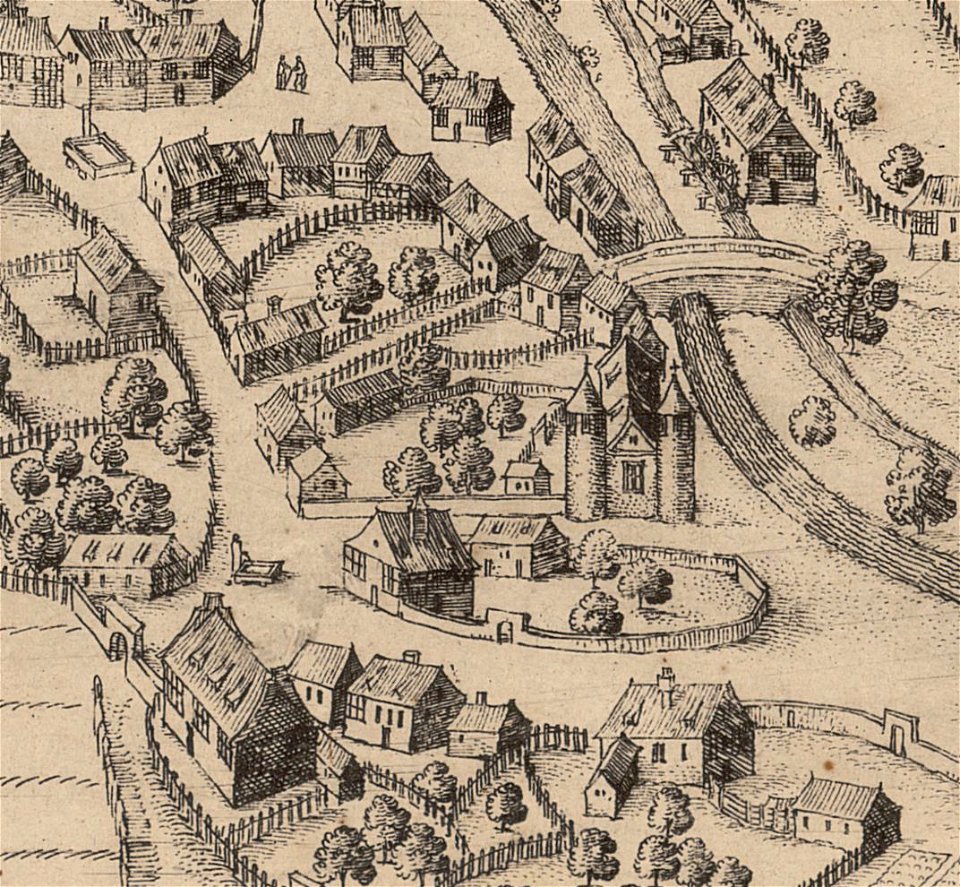
les anciens couvents de lyon
16th-century maps of lyon
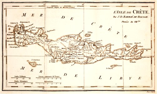
prints from the peace palace library
old maps of crete
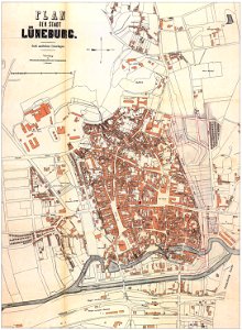
historical maps of lüneburg
stadtarchiv lüneburg
bibliothèque municipale de reims
rès. g 153
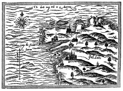
drawings by samuel de champlain
old maps of galicia (spain)
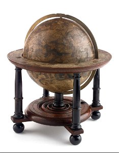
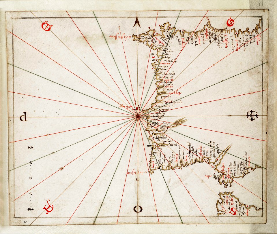
charts and maps of the royal museums greenwich
celestial globe
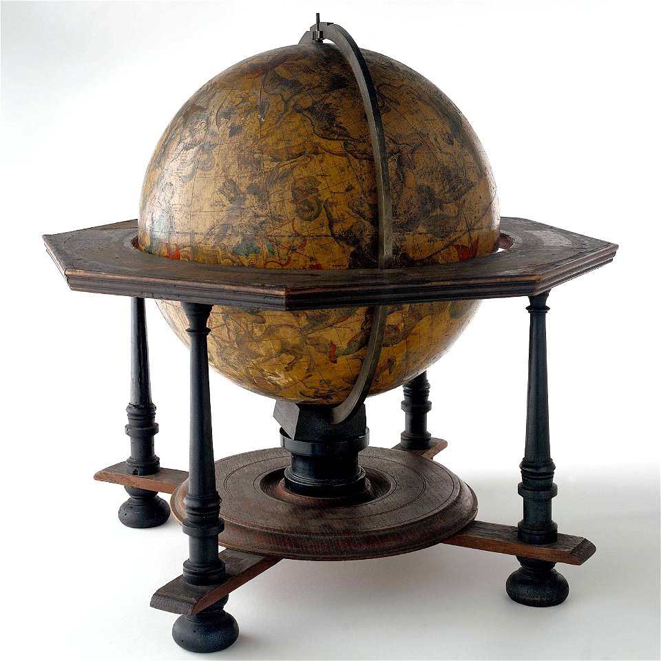
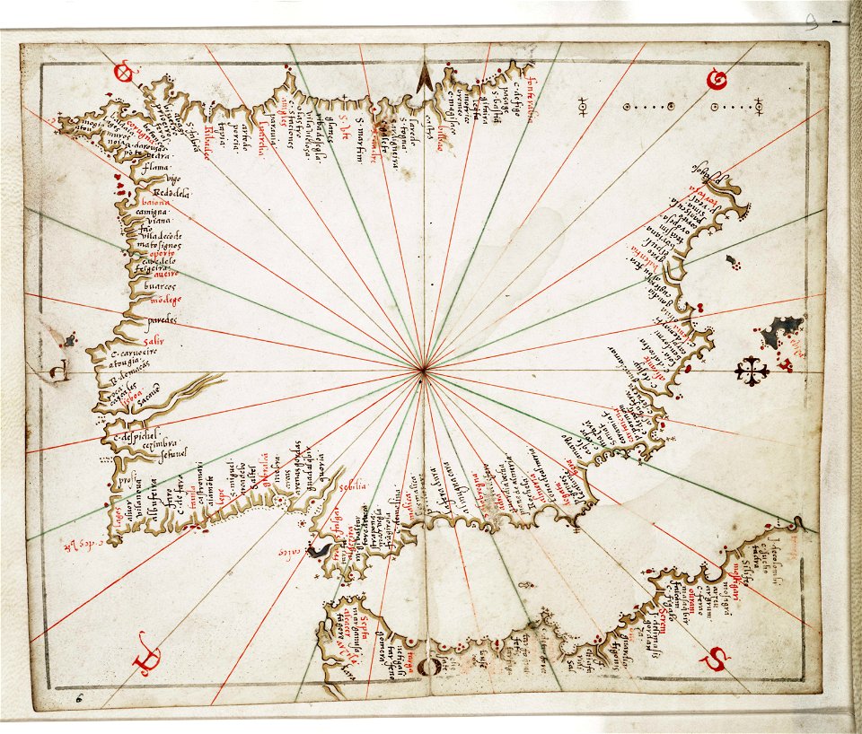
charts and maps of the royal museums greenwich
celestial globe
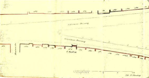
old maps of bremen (state)
bremen in the 1870s
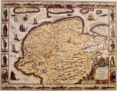
nicolaes van geelkercken
frederick de wit
la serena
chile
voyage pittoresque de la grèce
naoussa (paros)
paintings in the museum het prinsenhof
old maps of delft
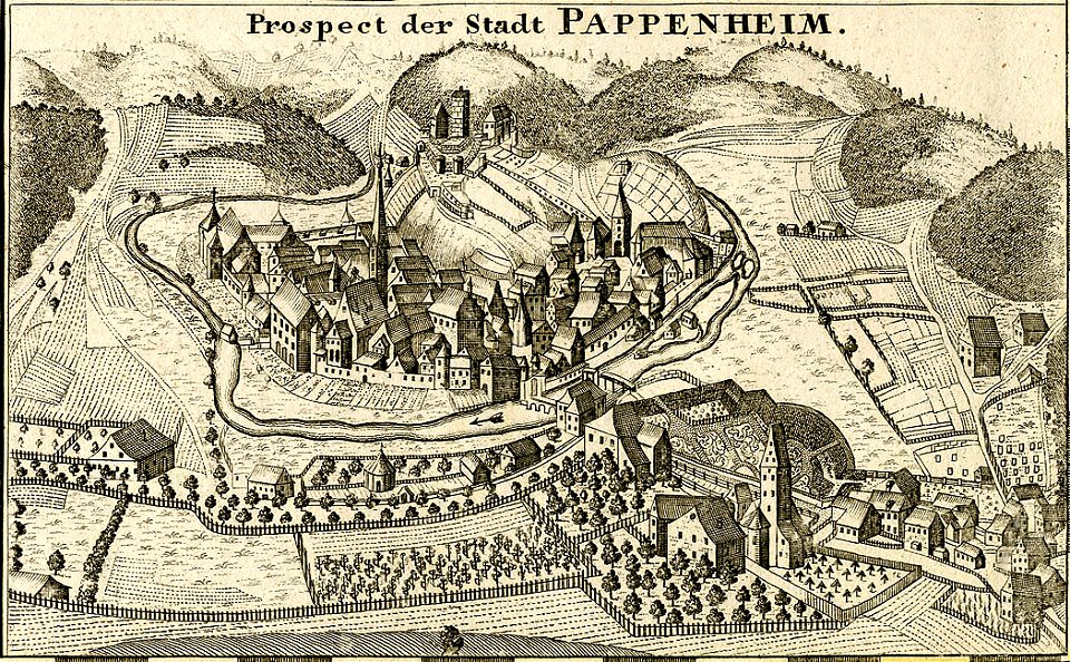
history of weingarten (württemberg)
maps by wenzel hollar
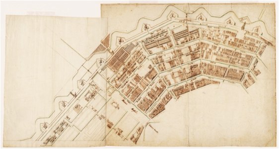
amsterdam in the 1680s
old maps of amsterdam
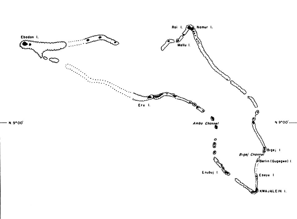
kwajalein atoll during world war ii
maps of kwajalein atoll
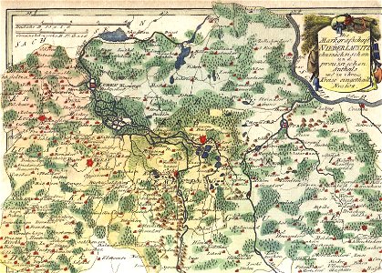
schauplatz der fünf theile der welt
old maps of lusatia
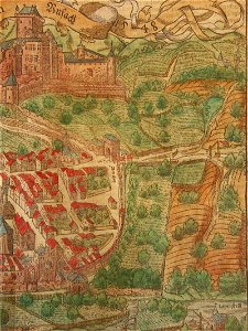
cosmographia (1600) by sebastian münster
maps of salins-les-bains
bibliothèque municipale de reims
rès. g 153
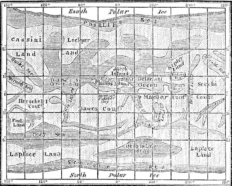
popular science monthly illustrations/volume 4
old maps of mars
maps by homannsche erben
johann baptist homann
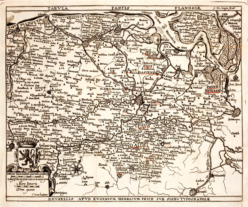
prints from the peace palace library
old maps of flanders
new york public library manuscripts
17th-century maps of saxony
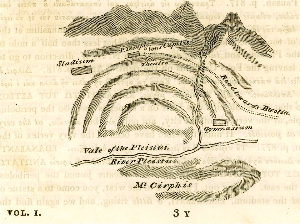
travels in sicily greece and albania
maps of ancient delphi
old maps of dutch brazil
johannes vingboons
liber insularum archipelagi (royal museums greenwich)
maps of kea (cyclades)
maps of stockholm county
tyresö slott
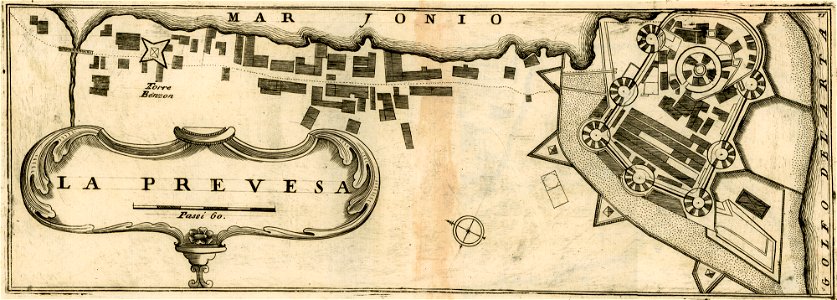
geographical illustrations by coronelli
maps of preveza
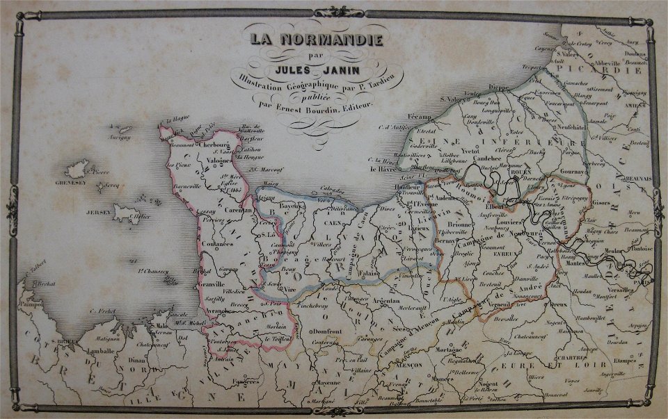
la normandie (jules janin)
alfred johannot
1751 maps of rhineland-palatinate
neuwied in the 18th century
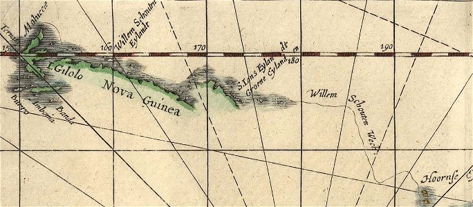
willem schouten
jacob le maire
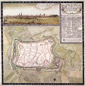
niedersächsisches landesarchiv
historical maps of lüneburg
historical maps of lüneburg
lüneburg in the 1730s
niedersächsisches landesarchiv
historical maps of lüneburg
bibliothèque municipale de reims
rès. g 153
charts and maps of the royal museums greenwich
joan martines
geographical illustrations by coronelli
old maps of the peloponnese
geographical illustrations by coronelli
koroni
charts and maps of the royal museums greenwich
joan martines
bibliothèque municipale de reims
rès. g 153
charts and maps of the royal museums greenwich
joan martines
charts and maps of the royal museums greenwich
joan martines
old maps of stockholm by georg biurman
ulvsunda slott - park
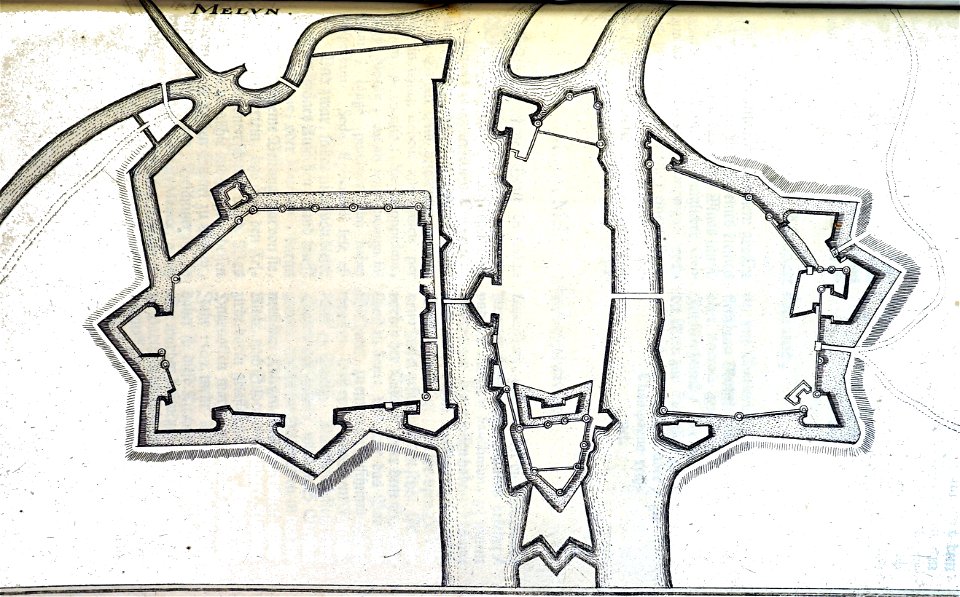
bibliothèque municipale de reims
rès. g 152
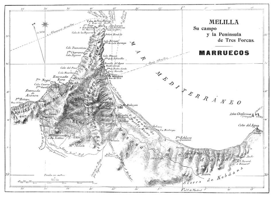
1909 la ilustración española y americana
old maps of melilla
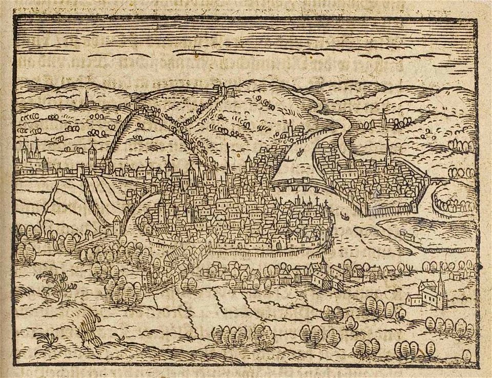
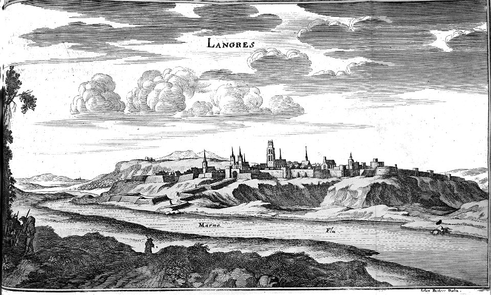
maps of liège in the 17th century
theatrum urbium (1610)
bibliothèque municipale de reims
rès. g 153
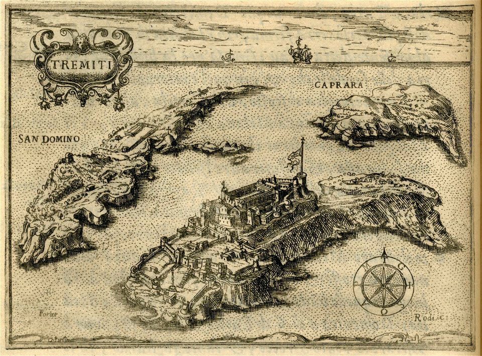
il devotissimo viaggio di gerusalemme fatto
maps of isole tremiti
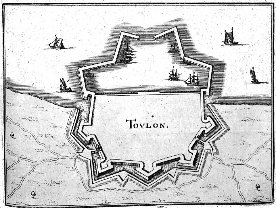
bibliothèque municipale de reims
rès. g 152
bibliothèque municipale de reims
rès. g 152
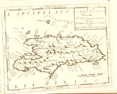
atlante veneto (raremaps.com) volume 2
17th-century maps of hispaniola
17th-century paintings, artist and year missing
17th-century paintings of francis xavier
7701 - 7800 of 1,096,578
Next page
/ 10966